
By Nick Waugh
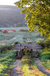
A keen observer walking almost anywhere in the woods of western Maine will notice remnants of the past: stone walls that once enclosed open fields, lilac-shrouded cellar holes that once housed thriving families, two-rut roads that lead seemingly nowhere. Some will see these things, enjoy them as part of the scenery, and stroll on. Others might pause to imagine the livestock that grazed in these now wooded pastures, or the lives lived above these cellar holes, or the wagons that dug these ruts.
The team members of the Western Foothills History Project fall squarely into the latter category: Why is there a Buckfield Hill in Byron? What’s the story of the Buckfield and Rumford Falls Railroad, or all those stagecoach lines that used to run hither and thither? What was it really like in the spring when the mighty Androscoggin and its tributaries roiled with a winter’s logs? Each of the 12 towns in the Western Foothills School District (RSU 10) has its own history and identity, but they all have much in common besides orphaned stone walls, abandoned cellar holes, and discontinued roads. Our partners hope that our exploration of municipal identities in this project will also lead us to a greater understanding of the things that connect us.
In both historical and modern times there is much to explore. Measured in square miles, RSU 10 is the largest school district east of the Mississippi; within it’s capacious boundaries lie a number of interesting features:

Abbot-Downing Concord Stagecoach, ca. 1882
Greater Rumford Area Historical Society
- The highest waterfall east of Niagara
- One of the world’s only moontide springs
- Mines that once produced some of the nations’s finest mica
- The mine that produced the world’s largest tourmaline
- A Olympic class Nordic ski facility
- The only town in America named Dixfield
- The birthplace of Edmund Muskie
- Those crazy Coke and Mentos guys
Native Americans—in this case the Abenakis—flourished in the western foothills for millennia before the arrival of Europeans. The first white settlers arrived in the late eighteenth century, drawn by the abundance of fish and game, timber, waterpower, and farm land. The hamlets they founded grew into towns that were incorporated between 1793 and 1843. Not by chance did these towns arise in close proximity to the region’s many rivers, streams, and lakes. The Androscoggin, Nezinscot, Ellis, Swift, Webb, and Twenty Mile Rivers all provided water power for mills and factories producing products of every description: lumber, paper, flour, leather, shoes, toothpicks, bowling pins, clothespins, shingles, barrels, tool handles. While water provided the power, the forests and fields provided the raw materials: first and foremost timber, but also grains, hay, hops, apples, cheese, starch, wool. Over time, Oxford County gained recognition as one of the most mineralogically active areas on earth and came to be known for its mica, precious gems, various ores, and even a bit of gold.
Maine is the most heavily wooded of the lower 48 states, and, despite the aforementioned diversity, the economy of the western foothills has always been dominated by its forest products. Even today this is true for the nine towns of the Androscoggin River Valley. While the valley’s shoeshops, tanneries, and novelty mills are gone, the paper mill built in Rumford in 1893, below the Great Falls of the Androscoggin, is still going strong and remains the engine of the local economy.

Young Edmund S. Muskie with his siblings, ca. 1922
Edmund S. Muskie Archives and Special Collections Library
Over the mountains, to the south, the three towns of the Nezinscot Region are powered by a more diversified economic engine, lying as they do between the cities of Lewiston/Auburn to the east, and Norway/South Paris to the west. While the region retains its rural small-town nature, inhabitants can much more easily commute to jobs in those cities and even Portland to the south.
The earliest settlers in the Western Foothills were of predominantly English extraction, and most arrived in the late 1780’s and early 1790’s, many homesteading on land granted to them for service in the French and Indian Wars and the Revolution. Most came from Massachusetts and coastal Maine. By the 1860’s, much of the big pine in the region had been cut, and many of the American-born loggers moved west, where the trees were bigger and the pay greater. This left a vacuum in the woods, which was filled by French Canadian and Scandinavian immigrants. Instead of pine, they turned to cutting spruce for lumber and pulp, as well as hemlock for the tanning industry. In the late 19th century, as paper mills, textile mills, and shoe factories proliferated along the Androscoggin, additional waves of immigrants, in the person of Italian and Eastern European masons, came to build them, while Canadians from Quebec and the Maritimes came to labor in them.
Google Maps tells us that the distance between Byron and Buckfield—respectively the northern and southern-most towns in RSU 10—is 43 miles, with a driving time of 61 minutes. One can imagine how long that journey used to take, on foot, on horseback, or in a stagecoach. Yet, for reasons both commercial and social, since the earliest times, people in this region have regularly made such journeys, and evidence of this connective web is strewn throughout the collections of the region’s historical societies. One goal of the Western Foothills History Project is to create a database through which the twelve towns can cross-reference this evidence in one another’s collections. In the process we may well learn that some of those two-rut roads through the woods lead, not nowhere, but to each other.